• Home
  • Shop Now!
    • Fine Art Photography – Capturing the Serenity of the Desert
    • Fine Art Photography – Wildlife Portraits
    • Fine Art Photography – Mountain Majesty
    • Fine Art Photography – Natural Scenes
    • Fine Art Photography – Travel
  • Wildlife
    • Antelopes
    • Reptiles
    • Birds
    • Camels
    • Other Animals
  • Landscapes
    • Explore the desert of the Middle East
    • Mountainside
    • Seascapes
  • Cityscapes
    • Cityscapes
  • Videos
    • Explore the World Through My Lens: A Video Portfolio Journey
    • DGP Video Media Stock: Discover a Diverse Collection of High-Quality Footage
  • Posts
  • About David
    • About David Gabis – Nature & Landscape Photography
    • Prints
    • Vintage and Antique cameras!
    • Contact me


Posted by DG on 24 Mar 2021 / 0 Comment

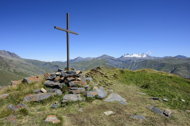
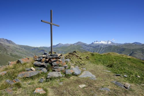
La Croix de Cassini (from le col de Sarenne), Isere, France 🇫🇷


"La Croix de Cassini" (alt. 2361 meters) offers a 360o panorama of all the surrounding peaks and ranges. Cassini de Thury, French astronomer and cartographer, used it for his measures and draw his maps 250 years ago.

“La Croix de Cassini” (alt. 2361 meters) offers a 360o panorama of all the surrounding peaks and ranges. Cassini de Thury, French astronomer and cartographer, used it for his measures and draw his maps 250 years ago.

  • Aperture: ƒ/11
  • Camera: NIKON D810
  • Caption: “La Croix de Cassini” (alt. 2361 meters) offers a 360o panorama of all the surrounding peaks and ranges. Cassini de Thury, French astronomer and cartographer, used it for his measures and draw his maps 250 years ago.
  • Taken: 12 August, 2017
  • Copyright: David@davidgabis.com
  • Focal length: 20mm
  • ISO: 100
  • Location: 45° 4.3851′ 0″ N 6° 8.0564′ 0″ E
  • Shutter speed: 1/400s
  • Title: La Croix de Cassini (from le col de Sarenne), Isere, France

Leave a Reply Cancel reply

You must be logged in to post a comment.


  • Contact Me

    Loading
  • Recent Posts

    • Dubai’s skyline
    • Gone Shooting shooting stars 💫
  • Other Profiles

    Go to my INSTAGRAM or BEHANCE profiles

    DM Me to use my Pictures

    #CaptureTheMoment


"La Croix de Cassini" (alt. 2361 meters) offers a 360o panorama of all the surrounding peaks and ranges. Cassini de Thury, French astronomer and cartographer, used it for his measures and draw his maps 250 years ago.

© Copyright – David Gabis

  • Aperture: ƒ/11
  • Camera: NIKON D810
  • Caption: “La Croix de Cassini” (alt. 2361 meters) offers a 360o panorama of all the surrounding peaks and ranges. Cassini de Thury, French astronomer and cartographer, used it for his measures and draw his maps 250 years ago.
  • Taken: 12 August, 2017
  • Copyright: David@davidgabis.com
  • Focal length: 20mm
  • ISO: 100
  • Location: 45° 4.3851′ 0″ N 6° 8.0564′ 0″ E
  • Shutter speed: 1/400s
  • Title: La Croix de Cassini (from le col de Sarenne), Isere, France

We are using cookies to give you the best experience on our website.

You can find out more about which cookies we are using or switch them off in .

David Gabis - Nature & Landscape Photography
Powered by  GDPR Cookie Compliance
Privacy Overview

This website uses cookies so that we can provide you with the best user experience possible. Cookie information is stored in your browser and performs functions such as recognising you when you return to our website and helping our team to understand which sections of the website you find most interesting and useful.

Strictly Necessary Cookies

Strictly Necessary Cookie should be enabled at all times so that we can save your preferences for cookie settings.

If you disable this cookie, we will not be able to save your preferences. This means that every time you visit this website you will need to enable or disable cookies again.